Real measured distances
"Riverside Elementary, 0.4 mi." Measured straight-line from the drone, not typed in by hand. Any distance can be hidden.
Aerial Studio · Intelligent aerial context
Aerial Studio understands where the drone was, what direction it faced, and which places are visible — then positions every label where it belongs.
$1 per aerial export · Preview and refine before you pay
Three quiet steps
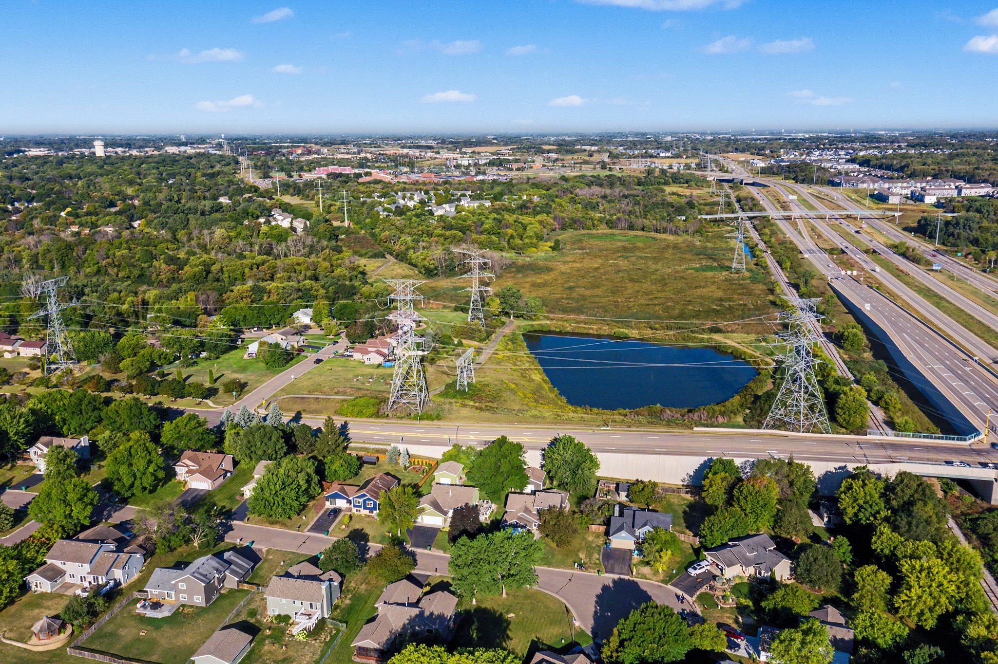
The drone recorded where it was, which way it was pointing, how high it was and what lens it used. That is enough to work out where any place on the ground falls in the frame — so the pins land on the right buildings instead of being dragged into position and eyeballed.
The camera tells the truth
Heading, altitude and field of view establish what the photograph can actually see.
Only useful context appears
Schools, parks, landmarks, retailers and worship — filtered to what earns a place.
Your eye stays in control
Adjust the selection, add your branding and export a polished listing image — $1 per aerial export.
On the photo you deliver
HDR merging strips the drone’s position and camera angle out of the finished file. Lumavo captures them at upload, from the original frames, and keeps them — so the full-quality, enhanced photo opens from your shoot with the pins placing themselves.
Not a map pasted over a photograph.
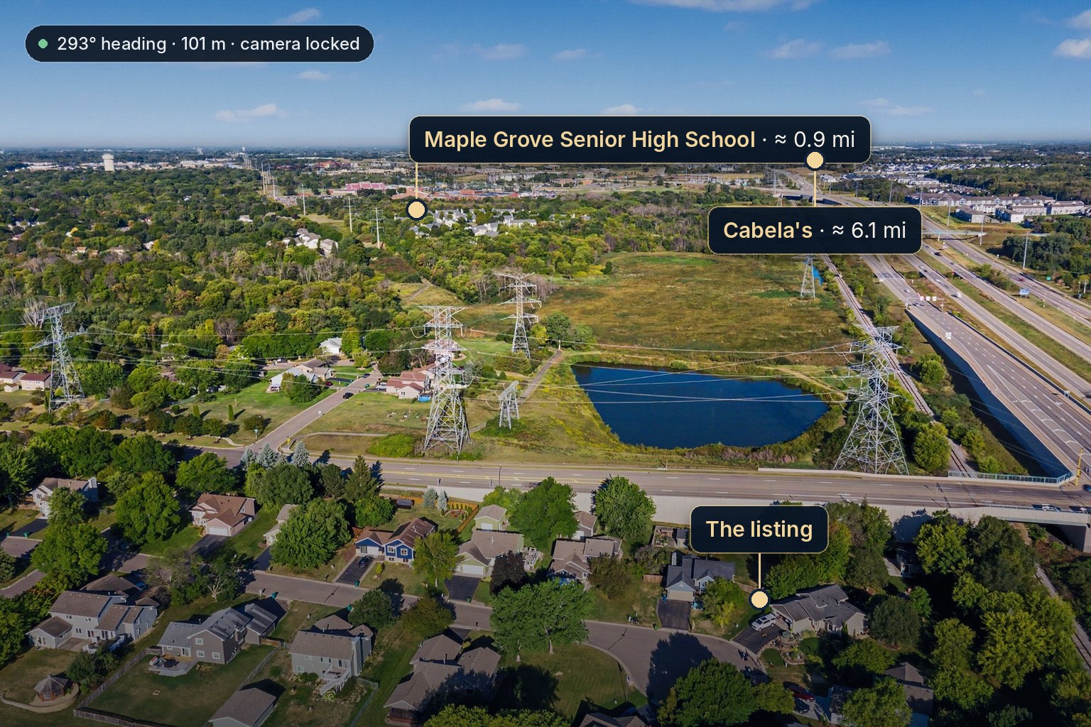
What the file said — the photograph above
Those four numbers, the drone’s position and each place’s coordinates are what put the three labels where they are. A place near the horizon is marked “≈”, because that is where a small error in tilt moves a pin furthest.
The projection does the placing. Every name, every pin and every distance is still yours to change before the photo goes out.
"Riverside Elementary, 0.4 mi." Measured straight-line from the drone, not typed in by hand. Any distance can be hidden.
If everything sits slightly off the buildings, drag one pin onto where it belongs and every other pin corrects with it, because they all share the same camera.
Trace the boundary and the shading dims everything outside it, so the lot is the brightest thing in the picture. A slider sets how strong.
Save the finished photo back to the shoot it came from, as a version beside the original — it goes out with the download, the listing and the delivery. The clean photograph is untouched.
Aerial Studio puts labeled pins on a drone photograph and places them for you. It reads the drone's own recorded position, heading, height and lens, works out which nearby places actually fall inside that frame, and puts a label at each one with the distance measured from the drone. You choose which places appear.
Yes. HDR merging strips the drone's GPS position and camera angle out of the finished file, so a tool that reads the photo you hand it has nothing left to read. Lumavo captures the camera position at upload, from the original frames, and keeps it — so the finished, full-quality photo opens from your shoot with the pins placing themselves.
Drag one pin onto where it belongs and every other pin corrects with it, because they all share the same camera — or move just that one. Place names come from Google Maps, which is often out of date about a neighborhood you shoot every week, so any name can be rewritten, a building can be searched for by name, and any distance can be hidden.
Yes. Click along the boundary corner by corner and close it. The shading dims everything outside the line, so the lot is the brightest thing in the frame, and a slider sets how strongly. Corners can be dragged afterwards and edges can be labeled with their lengths.
They are real measurements, straight-line from the drone to the place — not driving or walking distance, and they should never be presented as travel times.
$1 per aerial export, whether it carries pins, a lot line, a branded marker or all three. There is no subscription and no monthly credit allowance. Building and previewing are free, you are only charged for the full-resolution result, and every account's first annotated photo is free.
Aerial Studio
Built for real-estate media. $1 per aerial export, nothing monthly — and your first annotated photo is on us.
✦ Hi, I'm Juno — Lumavo's AI.
Ask me anything, or just say hi.